
Thank you for supporting this site ❤️
Make a donation
Make a donation
Gear up for your next adventure:
As an Amazon Associate, this site earns from qualifying purchases at no extra cost to you.
Gala topographic map
Click on the map to display elevation.
Thank you for supporting this site ❤️
Make a donation
Make a donation
Gear up for your next adventure:
As an Amazon Associate, this site earns from qualifying purchases at no extra cost to you.
About this map
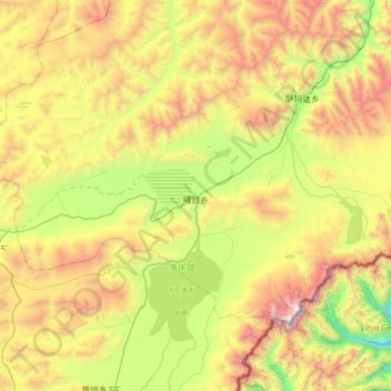
Name: Gala topographic map, elevation, terrain.
Location: Gala, Kangmar County, Shigatse Prefecture, Tibet, China (28.09348 89.01793 28.44098 89.64552)
Average elevation: 4,782 m
Minimum elevation: 3,703 m
Maximum elevation: 6,531 m
Thank you for supporting this site ❤️
Make a donation
Make a donation
Gear up for your next adventure:
As an Amazon Associate, this site earns from qualifying purchases at no extra cost to you.