
Eysturoy topographic map
Interactive map
Click on the map to display elevation.
About this map
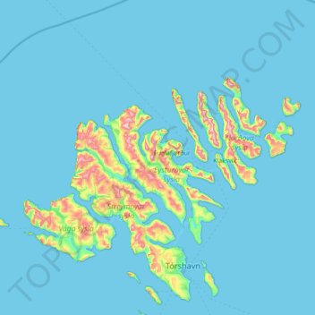
Name: Eysturoy topographic map, elevation, terrain.
Location: Eysturoy, Skálabotnur, Eysturoyar sýsla, 485, Islas Feroe (61.91110 -7.19723 62.55110 -6.55723)
Average elevation: 57 m
Minimum elevation: -4 m
Maximum elevation: 851 m