
Grudziądz topographic map
Interactive map
Click on the map to display elevation.
About this map
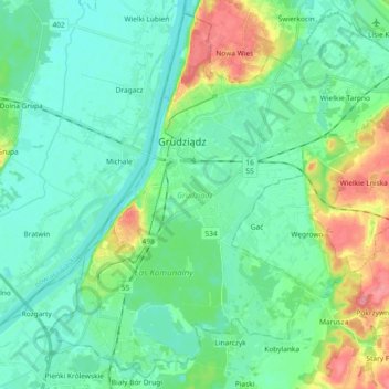
Name: Grudziądz topographic map, elevation, terrain.
Location: Grudziądz, Kuyavian-Pomeranian Voivodeship, Poland (53.42077 18.68607 53.52415 18.87091)
Average elevation: 31 m
Minimum elevation: 11 m
Maximum elevation: 91 m