Geolocate

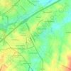
Faith topographic map

Click on the map to display elevation.

About this map

Name: Faith topographic map, elevation, terrain.

Location: Faith, Rowan County, North Carolina, 28041, United States (35.57851 -80.46985 35.60096 -80.44601)

Average elevation: 256 m

Minimum elevation: 224 m

Maximum elevation: 299 m

Other topographic maps

Click on a map to view its topography, its elevation and its terrain.

Mount Ulla

United States > North Carolina > Rowan County

Mount Ulla area landscape is typical for Piedmont plateau - rolling hills with elevations up to 800 (250 meters) above sea level punctuated by springs that feed into Beaverdam, Withrow, Back, and Sills creeks, which flow to the South Yadkin River.

Average elevation: 238 m

Gold Hill

United States > North Carolina > Rowan County

Average elevation: 224 m

Woodleaf

United States > North Carolina > Rowan County

Average elevation: 227 m

Mocksville

United States > North Carolina > Rowan County

Average elevation: 229 m

Gear up for your next adventure:

🧤Thermal Touchscreen Gloves - Stay warm while operating your GPS or smartphone camera
🧥Breathable Waterproof Jackets - Essential rain protection for the unpredictable British climate
👟Waterproof Leg Gaiters - Keep mud and water out of your boots in boggy terrain
❄️Walking Crampons - Added traction for icy slopes and winter peak bagging
🔥Emergency Fire Starters - Reliable ignition tools for survival situations in damp conditions

As an Amazon Associate, this site earns from qualifying purchases at no extra cost to you.