
Make a donation
Gear up for your next adventure:
As an Amazon Associate, this site earns from qualifying purchases at no extra cost to you.
Baruipur topographic map
Click on the map to display elevation.
Make a donation
Gear up for your next adventure:
As an Amazon Associate, this site earns from qualifying purchases at no extra cost to you.
Baruipur
Baruipur is located at 22°21′56″N 88°25′57″E / 22.3654432°N 88.4325028°E / 22.3654432; 88.4325028. It has an average elevation of 9 metres (30 ft).
Make a donation
Gear up for your next adventure:
As an Amazon Associate, this site earns from qualifying purchases at no extra cost to you.
About this map
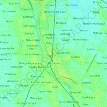
Name: Baruipur topographic map, elevation, terrain.
Location: Baruipur, South 24 Parganas, West Bengal, 700144, India (22.32324 88.40303 22.41238 88.46490)
Average elevation: 5 m
Minimum elevation: 0 m
Maximum elevation: 10 m
Make a donation
Gear up for your next adventure:
As an Amazon Associate, this site earns from qualifying purchases at no extra cost to you.