Geolocate

Ravoire topographic map

Interactive map

Click on the map to display elevation.

About this map

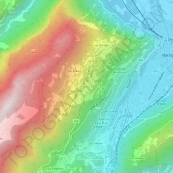
Name: Ravoire topographic map, elevation, terrain.

Location: Ravoire, Martigny-Combe, Martigny, Valais, 1921, Suisse (46.07582 7.02503 46.11582 7.06503)

Average elevation: 991 m

Minimum elevation: 454 m

Maximum elevation: 1,870 m

Other topographic maps

Click on a map to view its topography, its elevation and its terrain.

Le Fays

Suisse > Valais > Martigny > Martigny-Combe

Le Fays, Martigny-Combe, Martigny, Valais, 1921, Suisse

Average elevation: 1,402 m

La Caffe

Suisse > Valais > Martigny > Martigny-Combe > Le Fays

La Caffe, Le Fays, Martigny-Combe, Martigny, Valais, 1929, Suisse

Average elevation: 1,598 m

Chanton

Suisse > Valais > Martigny > Martigny-Combe > Le Fays

Chanton, Le Fays, Martigny-Combe, Martigny, Valais, 1921, Suisse

Average elevation: 1,452 m