
Singhat topographic map
Interactive map
Click on the map to display elevation.
About this map
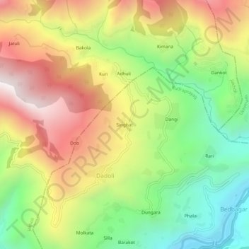
Name: Singhat topographic map, elevation, terrain.
Location: Singhat, Dadoli, Rudraprayag, Uttarakhand, 246421, India (30.39961 79.00488 30.43961 79.04488)
Average elevation: 1,362 m
Minimum elevation: 785 m
Maximum elevation: 2,022 m