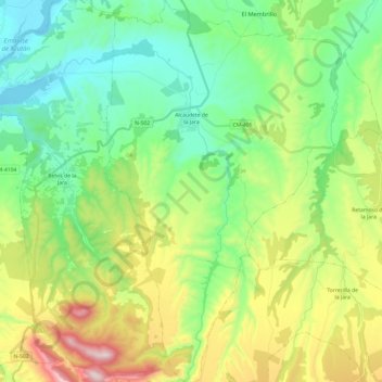
Alcaudete de la Jara topographic map
Interactive map
Click on the map to display elevation.
About this map
Name: Alcaudete de la Jara topographic map, elevation, terrain.
Average elevation: 573 m
Minimum elevation: 348 m
Maximum elevation: 1,058 m

Click on the map to display elevation.
Name: Alcaudete de la Jara topographic map, elevation, terrain.
Average elevation: 573 m
Minimum elevation: 348 m
Maximum elevation: 1,058 m