
Muyembe topographic map
Interactive map
Click on the map to display elevation.
About this map
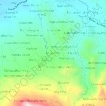
Name: Muyembe topographic map, elevation, terrain.
Location: Muyembe, Bugisa sub-region, Sironko, Eastern Region, Uganda (1.13159 34.31110 1.17159 34.35110)
Average elevation: 1,392 m
Minimum elevation: 1,194 m
Maximum elevation: 1,877 m