
Seiersdorf topographic map
Interactive map
Click on the map to display elevation.
About this map
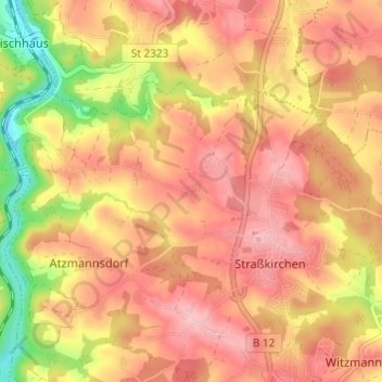
Name: Seiersdorf topographic map, elevation, terrain.
Average elevation: 406 m
Minimum elevation: 314 m
Maximum elevation: 458 m
Other topographic maps
Click on a map to view its topography, its elevation and its terrain.
Stolzesberg
Deutschland > Bayern > Landkreis Passau > Straßkirchen
Stolzesberg, Straßkirchen, Salzweg, Landkreis Passau, Bayern, 94121, Deutschland
Average elevation: 414 m