
Thank you for supporting this site ❤️
Make a donation
Make a donation
Gear up for your next adventure:
As an Amazon Associate, this site earns from qualifying purchases at no extra cost to you.
Nivin topographic map
Click on the map to display elevation.
Thank you for supporting this site ❤️
Make a donation
Make a donation
Gear up for your next adventure:
As an Amazon Associate, this site earns from qualifying purchases at no extra cost to you.
About this map
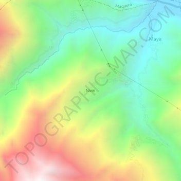
Name: Nivin topographic map, elevation, terrain.
Location: Nivin, Carhuaz, Áncash, 02127, Perú (-9.31548 -77.71072 -9.27548 -77.67072)
Average elevation: 3,211 m
Minimum elevation: 2,563 m
Maximum elevation: 4,214 m
Thank you for supporting this site ❤️
Make a donation
Make a donation
Gear up for your next adventure:
As an Amazon Associate, this site earns from qualifying purchases at no extra cost to you.