Geolocate

Chanderi topographic map

Click on the map to display elevation.

Chanderi

Chanderi is located at 24°43′N 78°08′E / 24.72°N 78.13°E / 24.72; 78.13. It has an average elevation of 456 metres (1496 feet).

Wikipedia (CC-BY-SA 3.0)

About this map

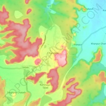
Name: Chanderi topographic map, elevation, terrain.

Location: Chanderi, Chanderi Tahsil, Ashoknagar, Madhya Pradesh, 473446, India (24.67194 78.09727 24.75194 78.17727)

Average elevation: 440 m

Minimum elevation: 362 m

Maximum elevation: 536 m

Other topographic maps

Click on a map to view its topography, its elevation and its terrain.

Rajghat dam

India > Madhya Pradesh > Chanderi Tahsil > Badera

Average elevation: 354 m

Dalla

India > Madhya Pradesh > Chanderi Tahsil

Average elevation: 348 m

Gear up for your next adventure:

🧴Sport Sunscreen Sticks - High-protection sunblock that won't run into your eyes on the trail
🔪Outdoor Multi-Tools - Versatile tools for gear repairs and food prep in the wild
🌄Outdoor Binoculars - Compact binoculars for landscape observation
🧦Merino Wool Hiking Socks - Moisture-wicking socks to prevent blisters during long mountain walks
🎒Hiking Child Carriers - Explore the outdoors with the whole family safely

As an Amazon Associate, this site earns from qualifying purchases at no extra cost to you.