Geolocate

Burrow topographic map

Click on the map to display elevation.

About this map

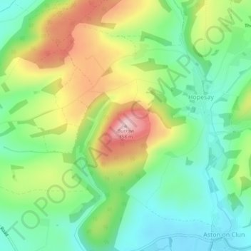
Name: Burrow topographic map, elevation, terrain.

Location: Burrow, Hopesay, Shropshire, England, SY7 8HA, United Kingdom (52.44219 -2.91191 52.44229 -2.91181)

Average elevation: 218 m

Minimum elevation: 134 m

Maximum elevation: 352 m

Shropshire trails, hiking, mountain biking, running and outdoor activities

Gear up for your next adventure:

🐕Hiking Dog Harnesses - Rugged harnesses for taking your companion on mountain trails
🔦Outdoor Torches - Reliable torches for night navigation
🧰First Aid Kits - Essential safety kits for outdoor activities
🎒Replacement Sternum Straps - Repair parts for hiking rucksacks
🧣Neck Gaiters - Protects against wind and sun on exposed ridges and peaks

As an Amazon Associate, this site earns from qualifying purchases at no extra cost to you.