Geolocate

Republic topographic map

Click on the map to display elevation.

About this map

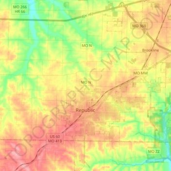
Name: Republic topographic map, elevation, terrain.

Location: Republic, Greene County, Missouri, 65738, United States (37.07462 -93.50709 37.19976 -93.38170)

Average elevation: 380 m

Minimum elevation: 327 m

Maximum elevation: 428 m

Other topographic maps

Click on a map to view its topography, its elevation and its terrain.

Bois D'Arc

United States > Missouri > Greene County

Average elevation: 371 m

Galloway

United States > Missouri > Greene County > Springfield

Average elevation: 380 m

Mentor

United States > Missouri > Greene County

Average elevation: 402 m

Ebenezer

United States > Missouri > Greene County

Average elevation: 380 m

Ebenezer

United States > Missouri > Greene County

Average elevation: 380 m

Riverpark

United States > Missouri > Greene County > Riverpark

Average elevation: 370 m

Gear up for your next adventure:

🧤Hiking Gloves - Warm and durable gloves for cold-weather walks
🧦Hiking Socks - Breathable socks designed to prevent blisters on long walks
📱Rugged Phone Cases - Heavy-duty protection for smartphones used as secondary GPS tools
🔦Outdoor Torches - Reliable torches for night navigation
🥾Hiking Boot Waterproofing Wax - Maintain the lifespan of your leather trekking boots

As an Amazon Associate, this site earns from qualifying purchases at no extra cost to you.