
Krumpa topographic map
Interactive map
Click on the map to display elevation.
About this map
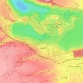
Name: Krumpa topographic map, elevation, terrain.
Location: Krumpa, Braunsbedra, Saalekreis, Sachsen-Anhalt, Deutschland (51.27146 11.81714 51.33324 11.86422)
Average elevation: 122 m
Minimum elevation: 20 m
Maximum elevation: 201 m
Other topographic maps
Click on a map to view its topography, its elevation and its terrain.
Geiseltalsee
Deutschland > Sachsen-Anhalt > Saalekreis > Braunsbedra
Geiseltalsee, Braunsbedra, Saalekreis, Sachsen-Anhalt, Deutschland
Average elevation: 112 m