
Târnăveni topographic map
Interactive map
Click on the map to display elevation.
About this map
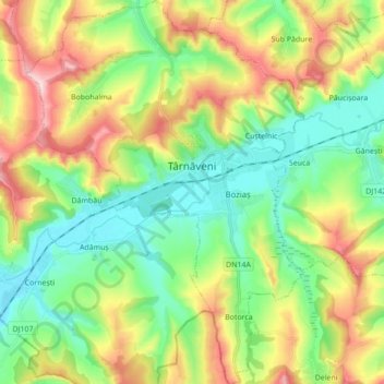
Name: Târnăveni topographic map, elevation, terrain.
Location: Târnăveni, Mureș, Romania (46.26129 24.20527 46.38111 24.33108)
Average elevation: 372 m
Minimum elevation: 273 m
Maximum elevation: 544 m
Other topographic maps
Click on a map to view its topography, its elevation and its terrain.