
Thank you for supporting this site ❤️
Make a donation
Make a donation
Gear up for your next adventure:
As an Amazon Associate, this site earns from qualifying purchases at no extra cost to you.
Bistra topographic map
Click on the map to display elevation.
Thank you for supporting this site ❤️
Make a donation
Make a donation
Gear up for your next adventure:
As an Amazon Associate, this site earns from qualifying purchases at no extra cost to you.
About this map
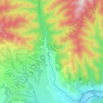
Name: Bistra topographic map, elevation, terrain.
Location: Bistra, Bistra Mureșului, Deda, Mureș, 547206, Romania (46.96396 24.87360 47.02275 24.91143)
Average elevation: 747 m
Minimum elevation: 473 m
Maximum elevation: 1,169 m
Thank you for supporting this site ❤️
Make a donation
Make a donation
Gear up for your next adventure:
As an Amazon Associate, this site earns from qualifying purchases at no extra cost to you.