Geolocate

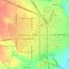
Buenos topographic map

Click on the map to display elevation.

About this map

Name: Buenos topographic map, elevation, terrain.

Location: Buenos, Garza County, Texas, United States (33.27926 -101.50765 33.31926 -101.46765)

Average elevation: 876 m

Minimum elevation: 815 m

Maximum elevation: 916 m

Other topographic maps

Click on a map to view its topography, its elevation and its terrain.
Post

United States > Texas > Garza County

Average elevation: 793 m

Gear up for your next adventure:

🧊Insulated Flasks - Keeps drinks hot or cold during hikes
🛰️Handheld GPS Devices - Reliable GPS units for hiking and outdoor navigation
🛌Insulated Sleeping Mats - Crucial thermal protection when sleeping on cold, uneven ground
🧤Thermal Touchscreen Gloves - Stay warm while operating your GPS or smartphone camera
🧥Softshell Jackets - Breathable jackets for active outdoor use

As an Amazon Associate, this site earns from qualifying purchases at no extra cost to you.