Geolocate

Luddenham topographic map

Click on the map to display elevation.

About this map

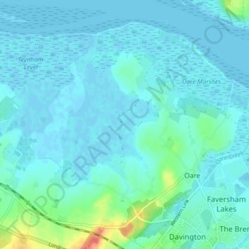
Name: Luddenham topographic map, elevation, terrain.

Location: Luddenham, Oare, Borough of Swale, Kent, England, United Kingdom (51.31770 0.83190 51.36007 0.87101)

Average elevation: 7 m

Minimum elevation: -3 m

Maximum elevation: 51 m

Kent trails, hiking, mountain biking, running and outdoor activities

Gear up for your next adventure:

🪓Outdoor Multitools - Versatile tools for hiking and camping
🧦Hiking Socks - Breathable socks designed to prevent blisters on long walks
📦Compression Sacks - Reduce backpack volume efficiently
🧢Waterproof Hiking Hats - Keep the rain off your face while studying topographic maps
🧊Insulated Flasks - Keeps drinks hot or cold during hikes

As an Amazon Associate, this site earns from qualifying purchases at no extra cost to you.