
Thank you for supporting this site ❤️
Make a donation
Make a donation
Gear up for your next adventure:
As an Amazon Associate, this site earns from qualifying purchases at no extra cost to you.
Grotta topographic map
Click on the map to display elevation.
Thank you for supporting this site ❤️
Make a donation
Make a donation
Gear up for your next adventure:
As an Amazon Associate, this site earns from qualifying purchases at no extra cost to you.
About this map
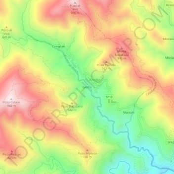
Name: Grotta topographic map, elevation, terrain.
Location: Grotta, Antillo, Messina, Sicilia, 98030, Italia (37.95560 15.22256 37.99560 15.26256)
Average elevation: 601 m
Minimum elevation: 246 m
Maximum elevation: 943 m
Thank you for supporting this site ❤️
Make a donation
Make a donation
Gear up for your next adventure:
As an Amazon Associate, this site earns from qualifying purchases at no extra cost to you.