
Thank you for supporting this site ❤️
Make a donation
Make a donation
Gear up for your next adventure:
As an Amazon Associate, this site earns from qualifying purchases at no extra cost to you.
Borgata topographic map
Click on the map to display elevation.
Thank you for supporting this site ❤️
Make a donation
Make a donation
Gear up for your next adventure:
As an Amazon Associate, this site earns from qualifying purchases at no extra cost to you.
About this map
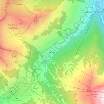
Name: Borgata topographic map, elevation, terrain.
Location: Borgata, Sestriere, Torino, Piemonte, 10058, Italia (44.95165 6.87363 44.99165 6.91363)
Average elevation: 2,135 m
Minimum elevation: 1,576 m
Maximum elevation: 2,804 m
Thank you for supporting this site ❤️
Make a donation
Make a donation
Gear up for your next adventure:
As an Amazon Associate, this site earns from qualifying purchases at no extra cost to you.