Geolocate

Combe Haven topographic map

Click on the map to display elevation.

About this map
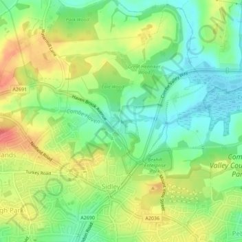
Name: Combe Haven topographic map, elevation, terrain.

Location: Combe Haven, Sidley, Bexhill-on-Sea, Rother, East Sussex, England, TN39 5AX, United Kingdom (50.86288 0.47694 50.86296 0.47710)

Average elevation: 27 m

Minimum elevation: 0 m

Maximum elevation: 59 m

East Sussex trails, hiking, mountain biking, running and outdoor activities

Gear up for your next adventure:

📷Camera Straps - Secure straps for carrying cameras while walking
🎒Replacement Sternum Straps - Repair parts for hiking rucksacks
🗺️Topographic Maps - Detailed maps showing elevation and terrain features
🥾Hiking Boots - Waterproof and durable boots for long-distance hiking in the UK
📐Altimeters & Barometers - Tools for measuring altitude and air pressure

As an Amazon Associate, this site earns from qualifying purchases at no extra cost to you.