Geolocate

Barreal topographic map

Click on the map to display elevation.

About this map

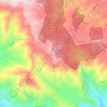
Name: Barreal topographic map, elevation, terrain.

Location: Barreal, Peñuelas, Puerto Rico, United States (18.07873 -66.76932 18.13519 -66.73230)

Average elevation: 690 m

Minimum elevation: 160 m

Maximum elevation: 1,040 m

Other topographic maps

Click on a map to view its topography, its elevation and its terrain.

Gear up for your next adventure:

🧗Locking Carabiners - Secure gear to your pack or for light technical use
Camping Shelters - Emergency and lightweight shelters for outdoor use
🔋Solar Chargers - Eco-friendly charging solutions for outdoor use
🖼️Topographic Map Art - Decorative 3D-effect posters of famous UK peaks and regions
🕶️Polarized Sunglasses - Reduces glare from snow and water when reading terrain

As an Amazon Associate, this site earns from qualifying purchases at no extra cost to you.