Geolocate

San Rocco Castagnaretta topographic map

Click on the map to display elevation.

About this map
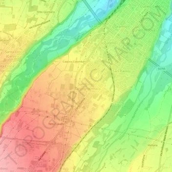
Name: San Rocco Castagnaretta topographic map, elevation, terrain.

Location: San Rocco Castagnaretta, Cuneo, Piemonte, 12100, Italia (44.34670 7.50225 44.38670 7.54225)

Average elevation: 569 m

Minimum elevation: 504 m

Maximum elevation: 627 m

Gear up for your next adventure:

🔦Keychain LED Torches - Emergency backup light for finding gear in your pack
🧥Softshell Jackets - Breathable jackets for active outdoor use
🔋Lithium AA Batteries - Long-lasting power that performs well in cold mountain weather
💧Hydration Reservoirs - Convenient water bladders for hands-free drinking on the move
📢Survival Whistles - Essential safety gear for signaling for help in mountain fog

As an Amazon Associate, this site earns from qualifying purchases at no extra cost to you.