
Smartsville topographic map
Interactive map
Click on the map to display elevation.
About this map
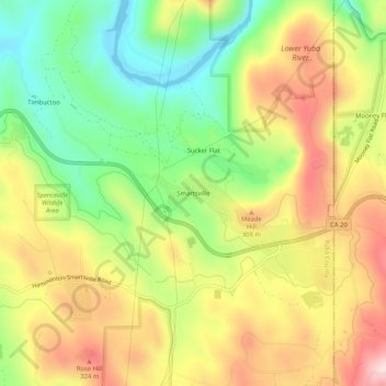
Name: Smartsville topographic map, elevation, terrain.
Location: Smartsville, Yuba County, California, 95977, United States (39.18739 -121.31857 39.22739 -121.27857)
Average elevation: 228 m
Minimum elevation: 69 m
Maximum elevation: 402 m
Other topographic maps
Click on a map to view its topography, its elevation and its terrain.