Geolocate

Askas topographic map

Click on the map to display elevation.

About this map

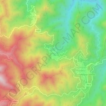
Name: Askas topographic map, elevation, terrain.

Location: Askas, Nicosia District, Cyprus (34.90963 33.05825 34.94963 33.09825)

Average elevation: 1,008 m

Minimum elevation: 681 m

Maximum elevation: 1,407 m

Gear up for your next adventure:

🎒Hiking Backpacks - Comfortable backpacks for day hikes and multi-day treks
👕Merino Base Layers - Natural temperature regulation for cold weather hiking and camping
🛌Sleeping Mats - Insulated mats for comfortable outdoor sleeping
🌂Windproof Trekking Umbrellas - Surprising but effective rain protection on low-wind trails
🕶️Polarized Sunglasses - Reduces glare from snow and water when reading terrain

As an Amazon Associate, this site earns from qualifying purchases at no extra cost to you.