
Rwerere topographic map
Interactive map
Click on the map to display elevation.
About this map
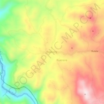
Name: Rwerere topographic map, elevation, terrain.
Location: Rwerere, Rukungiri, Western Region, Uganda (-0.81683 29.82619 -0.77683 29.86619)
Average elevation: 1,442 m
Minimum elevation: 1,155 m
Maximum elevation: 1,688 m