Geolocate

Karnal topographic map

Click on the map to display elevation.

About this map

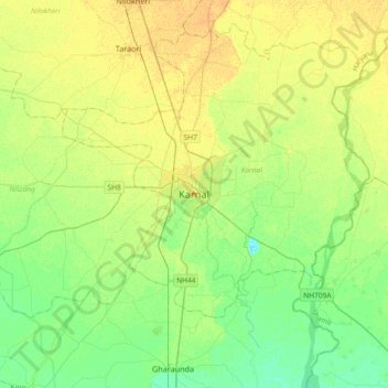
Name: Karnal topographic map, elevation, terrain.

Location: Karnal, Karnal District, Haryana, 132001, India (29.52033 76.82963 29.84033 77.14963)

Average elevation: 247 m

Minimum elevation: 235 m

Maximum elevation: 260 m

Gear up for your next adventure:

🌦️Portable Weather Meters - Handheld tools for monitoring weather conditions
🍳Camping Stoves - Compact stoves for outdoor cooking
🧷Tenacious Repair Tape - Instant fix for torn tents, jackets, or dry bags
🔦Head Torches - Hands-free lighting for hiking and camping
🧤Thermal Touchscreen Gloves - Stay warm while operating your GPS or smartphone camera

As an Amazon Associate, this site earns from qualifying purchases at no extra cost to you.