
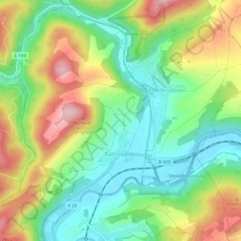
Rathsweiler topographic map
Interactive map
Click on the map to display elevation.
About this map
Name: Rathsweiler topographic map, elevation, terrain.
Average elevation: 268 m
Minimum elevation: 183 m
Maximum elevation: 395 m
The municipality lies near the river Glan in the Western Palatinate. Rathsweiler lies in the Glan valley near where the Steinalb empties into the Glan at an elevation of 187 m above sea level and at the foot of the Hohlbusch (403 m) and the Nollkopf (402 m). Within the village itself, elevations range from 195 to 220 m above sea level. The municipal area measures 425 ha, of which 116 ha is wooded and roughly 10 ha is settled. In 1987, 160 ha of land was sold to the Federal Republic and it now belongs to the Baumholder troop drilling ground.
Other topographic maps
Click on a map to view its topography, its elevation and its terrain.
Kusel
Germany > Rhineland-Palatinate > Landkreis Kusel
Kusel, Kusel-Altenglan, Landkreis Kusel, Rhineland-Palatinate, Germany
Average elevation: 311 m