
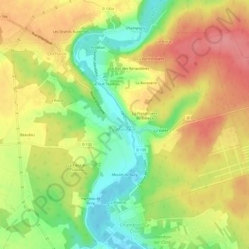
Les Pontonnières topographic map
Interactive map
Click on the map to display elevation.
About this map
Name: Les Pontonnières topographic map, elevation, terrain.
Average elevation: 117 m
Minimum elevation: 70 m
Maximum elevation: 159 m
Other topographic maps
Click on a map to view its topography, its elevation and its terrain.
Vienne
France > Centre-Val de Loire > Loir-et-Cher > Valencisse
Vienne, Molineuf, Valencisse, Blois, Loir-et-Cher, Centre-Val de Loire, France métropolitaine, 41190, France
Average elevation: 117 m
Chambon-sur-Cisse
France > Centre-Val de Loire > Loir-et-Cher > Valencisse
Chambon-sur-Cisse, Valencisse, Blois, Loir-et-Cher, Centre-Val de Loire, France métropolitaine, 41190, France
Average elevation: 106 m