Geolocate

Lafurak topographic map

Click on the map to display elevation.

About this map

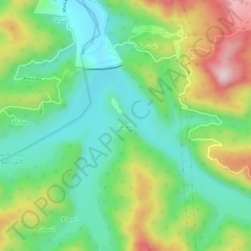
Name: Lafurak topographic map, elevation, terrain.

Location: Lafurak, دهستان لفور, بخش بندپی شرقی, Babol County, Mazandaran Province, Iran (36.19712 52.79101 36.23712 52.83101)

Average elevation: 358 m

Minimum elevation: 225 m

Maximum elevation: 597 m

Other topographic maps

Click on a map to view its topography, its elevation and its terrain.

Gear up for your next adventure:

🧺Ultralight Dry Bags - Organize and waterproof your gear inside your rucksack
🥾Hiking Boots - Waterproof and durable boots for long-distance hiking in the UK
🛰️Satellite Messengers - Emergency communication devices for areas without mobile signal
📕Outdoor Navigation Books - Learn traditional and modern navigation techniques
🔦Waterproof LED Headlamps - Hands-free lighting for evening treks and emergency navigation

As an Amazon Associate, this site earns from qualifying purchases at no extra cost to you.