
Jonkershove topographic map
Interactive map
Click on the map to display elevation.
About this map
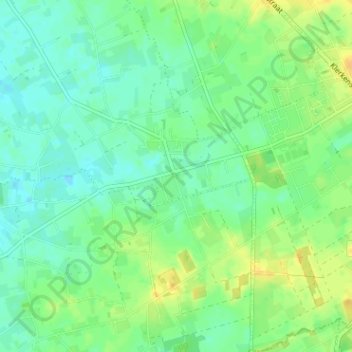
Name: Jonkershove topographic map, elevation, terrain.
Location: Jonkershove, Houthulst, Diksmuide, West-Vlaanderen, 8650, België (50.94848 2.89235 50.98848 2.93235)
Average elevation: 13 m
Minimum elevation: 3 m
Maximum elevation: 27 m
Other topographic maps
Click on a map to view its topography, its elevation and its terrain.
Houthulst
België > West-Vlaanderen > Diksmuide > Houthulst
Houthulst, Diksmuide, West-Vlaanderen, België
Average elevation: 19 m
Merkem
België > West-Vlaanderen > Diksmuide > Houthulst
Merkem, Houthulst, Diksmuide, West-Vlaanderen, België
Average elevation: 5 m
Klerken
België > West-Vlaanderen > Diksmuide > Houthulst
Klerken, Houthulst, Diksmuide, West-Vlaanderen, Vlaanderen, 8650, België
Average elevation: 13 m