
Podgore topographic map
Interactive map
Click on the map to display elevation.
About this map
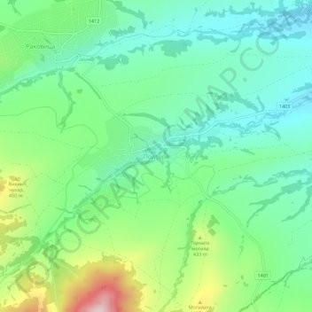
Name: Podgore topographic map, elevation, terrain.
Location: Podgore, Makresh, Vidin, Bulgaria (43.72968 22.47178 43.76968 22.51178)
Average elevation: 365 m
Minimum elevation: 262 m
Maximum elevation: 604 m
Other topographic maps
Click on a map to view its topography, its elevation and its terrain.