
Bel Ombre topographic map
Interactive map
Click on the map to display elevation.
About this map
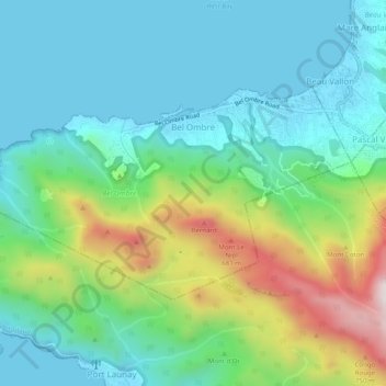
Name: Bel Ombre topographic map, elevation, terrain.
Location: Bel Ombre, Seychelles (-4.64140 55.38219 -4.61422 55.43152)
Average elevation: 211 m
Minimum elevation: -1 m
Maximum elevation: 792 m
Other topographic maps
Click on a map to view its topography, its elevation and its terrain.