
Salterforth topographic map
Interactive map
Click on the map to display elevation.
About this map
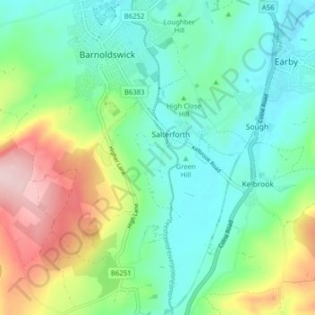
Name: Salterforth topographic map, elevation, terrain.
Average elevation: 205 m
Minimum elevation: 128 m
Maximum elevation: 382 m
Other topographic maps
Click on a map to view its topography, its elevation and its terrain.
Wycoller Beck
United Kingdom > England > Pendle
Wycoller Beck, Pendle, Lancashire, North West England, England, BB8 8SU, United Kingdom
Average elevation: 301 m
Pendle Water
United Kingdom > England > Pendle
Pendle Water, Pendle, Lancashire, North West England, England, BB9 6EW, United Kingdom
Average elevation: 169 m
River Laneshaw
United Kingdom > England > Pendle
River Laneshaw, Pendle, Lancashire, North West England, England, BB8 7HH, United Kingdom
Average elevation: 247 m