Geolocate

Eureka topographic map

Click on the map to display elevation.

About this map
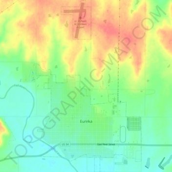
Name: Eureka topographic map, elevation, terrain.

Location: Eureka, Greenwood County, Kansas, 67045, United States (37.81049 -96.30604 37.85605 -96.27067)

Average elevation: 341 m

Minimum elevation: 313 m

Maximum elevation: 374 m

Other topographic maps

Click on a map to view its topography, its elevation and its terrain.

Temple Knob

United States > Kansas > Greenwood County

Average elevation: 460 m

Reece

United States > Kansas > Greenwood County

Average elevation: 378 m

Gear up for your next adventure:

📢Survival Whistles - Essential safety gear for signaling for help in mountain fog
🧴Tick Removal Tools - Small, essential health tool for UK woodland and moorland
🥄Titanium Camping Sporks - The ultimate lightweight utensil for trail meals
🧊Personal Water Filters - Drink safely from mountain streams marked on your map
📷Outdoor Action Cameras - Cameras designed for hiking and adventure

As an Amazon Associate, this site earns from qualifying purchases at no extra cost to you.