Geolocate

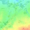
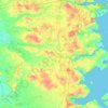
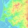
Gørding topographic map

Click on the map to display elevation.

About this map

Name: Gørding topographic map, elevation, terrain.

Location: Gørding, Esbjerg Municipality, Region of Southern Denmark, 6690, Denmark (55.45342 8.77995 55.49342 8.81995)

Average elevation: 21 m

Minimum elevation: 9 m

Maximum elevation: 39 m

Other topographic maps

Click on a map to view its topography, its elevation and its terrain.
Funen

Denmark > Region of Southern Denmark

Average elevation: 19 m

Funen

Denmark > Region of Southern Denmark

Average elevation: 19 m

Funen

Denmark > Region of Southern Denmark

Average elevation: 19 m

Funen

Denmark > Region of Southern Denmark

Average elevation: 19 m

Rømø

Denmark > Region of Southern Denmark

Average elevation: 0 m

Skarø

Denmark > Region of Southern Denmark

Average elevation: 0 m

Guldbjerg

Denmark > Region of Southern Denmark

Average elevation: 23 m

Egholm

Denmark > Region of Southern Denmark

Average elevation: 0 m

Funen

Denmark > Region of Southern Denmark

Average elevation: 19 m

Funen

Denmark > Region of Southern Denmark

Average elevation: 19 m

Ærø

Denmark > Region of Southern Denmark

Average elevation: 3 m

Gear up for your next adventure:

🗺️Ordnance Survey Maps - Official UK maps for walking and outdoor activities
🍳Camping Stoves - Compact stoves for outdoor cooking
🐕Dog Hiking Gear - Equipment for hiking safely with dogs
🔋Lithium AA Batteries - Long-lasting power that performs well in cold mountain weather
🥤Hiking Water Bottles - Reusable bottles for hydration on the trail

As an Amazon Associate, this site earns from qualifying purchases at no extra cost to you.