
Thank you for supporting this site ❤️
Make a donation
Make a donation
Gear up for your next adventure:
As an Amazon Associate, this site earns from qualifying purchases at no extra cost to you.
Faete topographic map
Click on the map to display elevation.
Thank you for supporting this site ❤️
Make a donation
Make a donation
Gear up for your next adventure:
As an Amazon Associate, this site earns from qualifying purchases at no extra cost to you.
About this map
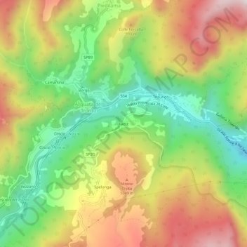
Name: Faete topographic map, elevation, terrain.
Location: Faete, Arquata del Tronto, Ascoli Piceno, Marche, Italia (42.74968 13.28435 42.78968 13.32435)
Average elevation: 860 m
Minimum elevation: 524 m
Maximum elevation: 1,247 m
Thank you for supporting this site ❤️
Make a donation
Make a donation
Gear up for your next adventure:
As an Amazon Associate, this site earns from qualifying purchases at no extra cost to you.