
Ladeuze topographic map
Interactive map
Click on the map to display elevation.
About this map
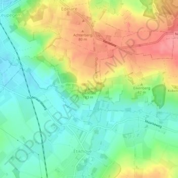
Name: Ladeuze topographic map, elevation, terrain.
Location: Ladeuze, Audenarde, Flandre orientale, Flandre, 9680, Belgique (50.82232 3.62751 50.82242 3.62761)
Average elevation: 46 m
Minimum elevation: 11 m
Maximum elevation: 95 m
Other topographic maps
Click on a map to view its topography, its elevation and its terrain.
Wolvenberg
Belgique > Flandre > Audenarde
Wolvenberg, Audenarde, Flandre orientale, Flandre, 9700, Belgique
Average elevation: 55 m