
Santa Cruz de Llanera topographic map
Interactive map
Click on the map to display elevation.
About this map
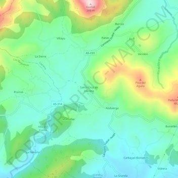
Name: Santa Cruz de Llanera topographic map, elevation, terrain.
Location: Santa Cruz de Llanera, Llanera, Asturien, 33411, Spanien (43.44186 -5.95180 43.48186 -5.91180)
Average elevation: 273 m
Minimum elevation: 157 m
Maximum elevation: 561 m
Other topographic maps
Click on a map to view its topography, its elevation and its terrain.