Geolocate

Iconi topographic map

Interactive map

Click on the map to display elevation.

About this map

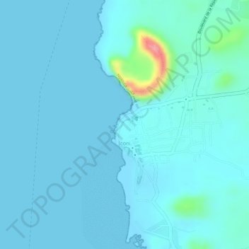
Name: Iconi topographic map, elevation, terrain.

Location: Iconi, Grande Comore, Comoros (-11.75072 43.23120 -11.73769 43.24585)

Average elevation: 13 m

Minimum elevation: 0 m

Maximum elevation: 121 m

Other topographic maps

Click on a map to view its topography, its elevation and its terrain.

Vanadjou

Comoros > Grande Comore > Vanadjou

Vanadjou, Grande Comore, Comoros

Average elevation: 311 m

Moroni

Comoros > Grande Comore

Moroni, Grande Comore, Comoros

Average elevation: 351 m

Ouziouani

Comoros > Grande Comore

Ouziouani, Grande Comore, Comoros

Average elevation: 243 m

Mount Karthala

Comoros > Grande Comore > Moroni

Mount Karthala, Moroni, Grande Comore, Comoros

Average elevation: 2,248 m