
Raubling topographic map
Interactive map
Click on the map to display elevation.
About this map
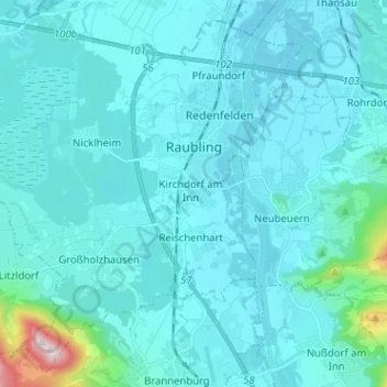
Name: Raubling topographic map, elevation, terrain.
Location: Raubling, Landkreis Rosenheim, Bayern, 83064, Deutschland (47.73946 12.01864 47.81821 12.14596)
Average elevation: 494 m
Minimum elevation: 441 m
Maximum elevation: 1,099 m
Other topographic maps
Click on a map to view its topography, its elevation and its terrain.
Rott am Inn
Deutschland > Bayern > Landkreis Rosenheim > Rott am Inn
Rott am Inn, Rott am Inn (VGem), Landkreis Rosenheim, Bayern, 83543, Deutschland
Average elevation: 465 m