
Odalengo Grande topographic map
Interactive map
Click on the map to display elevation.
About this map
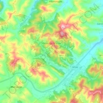
Name: Odalengo Grande topographic map, elevation, terrain.
Location: Odalengo Grande, Alessandria, Piedmont, Italy (45.08078 8.12111 45.12889 8.20814)
Average elevation: 264 m
Minimum elevation: 170 m
Maximum elevation: 424 m
Other topographic maps
Click on a map to view its topography, its elevation and its terrain.