
Lac-Miroir topographic map
Interactive map
Click on the map to display elevation.
About this map
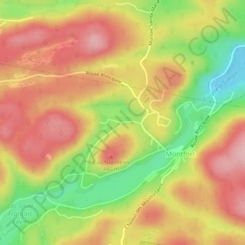
Name: Lac-Miroir topographic map, elevation, terrain.
Average elevation: 429 m
Minimum elevation: 331 m
Maximum elevation: 502 m
Other topographic maps
Click on a map to view its topography, its elevation and its terrain.
Lac-Diez-d'Aux
Canada > Québec > Wentworth-Nord
Lac-Diez-d'Aux, Wentworth-Nord, Les Pays-d'en-Haut, Laurentides, Québec, Canada
Average elevation: 421 m