
Vieska nad Žitavou topographic map
Interactive map
Click on the map to display elevation.
Vieska nad Žitavou
The municipality lies at an altitude of 170 metres and covers an area of 5.465 km2. It has a population of about 442 people.
About this map
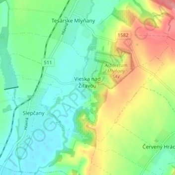
Name: Vieska nad Žitavou topographic map, elevation, terrain.
Average elevation: 179 m
Minimum elevation: 150 m
Maximum elevation: 231 m