
Gunungduren topographic map
Interactive map
Click on the map to display elevation.
About this map
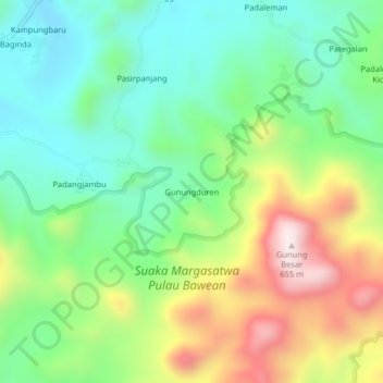
Name: Gunungduren topographic map, elevation, terrain.
Location: Gunungduren, Gresik, East Java, Java, Indonesia (-5.80406 112.62239 -5.76406 112.66239)
Average elevation: 225 m
Minimum elevation: 8 m
Maximum elevation: 616 m