
Bonnington topographic map
Click on the map to display elevation.
About this map
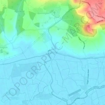
Name: Bonnington topographic map, elevation, terrain.
Location: Bonnington, Ashford, Kent, England, United Kingdom (51.05486 0.91995 51.08840 0.95440)
Average elevation: 17 m
Minimum elevation: -1 m
Maximum elevation: 95 m
Kent trails, hiking, mountain biking, running and outdoor activities
Other topographic maps
Click on a map to view its topography, its elevation and its terrain.
Ham Street Woods National Nature Reserve
United Kingdom > England > Kent > Ashford > Hamstreet
Average elevation: 31 m
Wye National Nature Reserve
United Kingdom > England > Kent > Ashford > Brook
Average elevation: 123 m