Geolocate

Seagrave topographic map

Click on the map to display elevation.

About this map
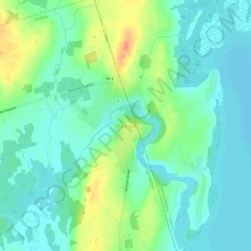
Name: Seagrave topographic map, elevation, terrain.

Location: Seagrave, Scugog, Durham Region, Golden Horseshoe, Ontario, Canada (44.18025 -78.96524 44.22025 -78.92524)

Average elevation: 262 m

Minimum elevation: 247 m

Maximum elevation: 297 m

Other topographic maps

Click on a map to view its topography, its elevation and its terrain.

Apple Vally Park

Canada > Ontario > Durham Region > Scugog > Port Perry

Average elevation: 261 m

Gear up for your next adventure:

📱Rugged Phone Cases - Heavy-duty protection for smartphones used as secondary GPS tools
🛰️Handheld GPS Devices - Reliable GPS units for hiking and outdoor navigation
🩹Hiking First Aid Kits - Compact medical kits tailored for trail injuries and emergencies
🧥Breathable Waterproof Jackets - Essential rain protection for the unpredictable British climate
🧊Insulated Flasks - Keeps drinks hot or cold during hikes

As an Amazon Associate, this site earns from qualifying purchases at no extra cost to you.