
Hickory Creek topographic map
Interactive map
Click on the map to display elevation.
About this map
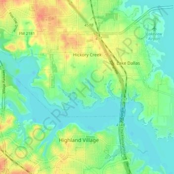
Name: Hickory Creek topographic map, elevation, terrain.
Location: Hickory Creek, Denton County, Texas, United States (33.09135 -97.06763 33.13007 -96.99336)
Average elevation: 169 m
Minimum elevation: 153 m
Maximum elevation: 196 m