
Baugy topographic map
Interactive map
Click on the map to display elevation.
About this map
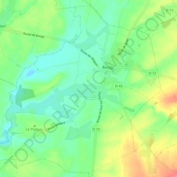
Name: Baugy topographic map, elevation, terrain.
Average elevation: 178 m
Minimum elevation: 157 m
Maximum elevation: 217 m
Other topographic maps
Click on a map to view its topography, its elevation and its terrain.
Lustambourg
France > Centre-Val de Loire > Cher > Baugy
Lustambourg, Saligny-le-Vif, Baugy, Bourges, Cher, Centre-Val de Loire, France métropolitaine, 18800, France
Average elevation: 201 m